Thursday, January 28, 2016

A Journey to Geography

People often ask me what drew me into a career involving maps.  Of course I took social studies classes in grade school to learn basic geography and I had to study and understand the maps that were parts of history lessons, but I never took a dedicated geography class. It was actually just a serendipitous event; during my long, self-funded path through graduate school, I took a job to help pay the bills.  

I was a research assistant on a grant given by a funding organization that wanted to make better funding decisions.  They wanted to be able to look at data for traditional geographies that did not fit into US Census Bureau geographies.  Most publicly-available health data do conform to these geopolitical boundaries such as census tracts, counties and states.  So there were two massive undertakings (both of which pre-dated my involvement in the project): 1) using Geographic Information Systems (GIS), create the boundaries of these traditional neighborhoods, and 2) collect data from the people in each neighborhood to learn what their health needs/ concerns were.

Once the data were collected and mapped, the funder could then evaluate funding proposals based on neighborhood need.  For example, if an agency was seeking funding to start a maternal and child health clinic Downtown, the funder could reference their geographic data and to assess whether maternal and child health was a major issue for the people in the neighborhood.  If not, they could see for which neighborhood it was a major issue and then go back to the agency and let them know the original proposal would not be funded, but if they wanted to focus on HIV/ AIDS in Downtown for example, the proposal would be stronger and more likely to be funded.  Or if the agency really wanted to focus on maternal and child health, the need for those services was greatest in the West End.  The concept fascinated me and once I taught myself how to use GIS, I was hooked. The project itself has morphed into a data center that serves all of southeast Louisiana (http://www.datacenterresearch.org/about-us/the-data-center-an-overview/).

I’ve been lucky to stay connected to geography throughout my career in health policy, although it wasn’t always easy.  My career has gone from using maps to show locations of health care providers to building online tools that help people navigate the health care system to now managing a portfolio of online mapping tools that democratize data and allow thousands of people do the same kind analyses on the fly that I was doing in graduate school using population health, health workforce and user-provided data.  

Come to one of our upcoming webinars to get hooked on mapping!

Jennifer Rankin
Senior Manager, Product and Resource Services 
HealthLandscape
 

Tuesday, January 19, 2016

GIS and Meetup.com!

Meetup.com is a social networking website designed for anyone in search of something to do, learn, interact with, and get involved in the community with like-minded people. You can find a meetup in just about any major metropolitan city including Washington, D.C., one of the leading utilizers of the site.


You can find anything from hiking and rock climbing to speed dating to national park tours to Python programming workshops. Other popular meetup topics include happy hours, single-mom coffee meetings, running clubs, and seminars and conferences.

There are several GIS/geography meetup groups that tailor to the working DC professional, including Esri DC Meet Ups and Geo DC. The former is a group put on by staff at the local Esri R&D center in Arlington, Virginia which showcases new cloud, web, and mobile technologies related to Esri products. To those interested, these meetups consist of talks, lectures, and hands-on learning sessions. Recent topics have included, “Drones and GIS – a Powerful Combination”, “Maps Bring Your Story to Life”, and “Geospatial Technology for Fraud Analytics”.


The second GIS related DC meetup group is called Geo DC. This group is for GIS professionals of all levels and interests and meets once a month for lightning talks and networking. Unlike the Esri DC Meet Ups group, Geo DC tends to cover open source technologies as well as Esri products. The monthly meetings are held at a local bar for a few hours and host an average of 90+ participants. The meetings start with introductions, and then lead into several lightning talks and demonstrations. Afterwards, it turns into a networking social. Recent meeting topics have covered “#Maps: social media and mapping”, “OpenStreetMap: June GeoDC”, and “November GeoDC: Geo Policy”.


Dave Grolling 
GIS Strategist
HealthLandscape

Monday, January 11, 2016

Introducing our GIS Strategist

We’re starting off 2016 by welcoming Dave Grolling to the HealthLandscape team. Dave will be taking on the role of GIS Strategist, working with our geospatial data and services. Dave is a graduate of the Master of Professional Studies in GIS program, at the University of Maryland. He completed his undergraduate degree in Anthropology at SUNY Brockport. In his undergraduate studies, he completed a student research project, interviewing patients in two hospital emergency departments to investigate ER over-utilization.


He brings a great combination of intellectual curiosity and technical skills (including ESRI ArcGIS Software, SAS, SQL, and Javascript). Dave is already diving into multiple projects his first week with HealthLandscape and we’re very excited to have him on board. Welcome, Dave!


Jené Grandmont
Senior Manager, Application Development and Data Services
HealthLandscape

Friday, December 4, 2015

The HealthLandscape Crew Continues to Grow

Say “Hello!” to our new User Engagement Specialist!


If you have requested help using the UDS Mapper or attended any of our monthly webinars you have already had the pleasure of meeting Claire Meehan.


Claire Meehan received her B.S in Health, Fitness and Recreation Resources with a Concentration in Health Promotion at George Mason University. Prior to joining HealthLandscape she assisted in managing workplace health initiatives for a non-profit hospital.


Her primary responsibilities for HealthLandscape include customer support and user engagement. She provides training and technical support to users as well as manages communications and marketing efforts for HealthLandscape.

2015-12-03_1012.png


Welcome!

Jennifer Rankin
Senior Manager, Research and Product Services
HealthLandscape

Wednesday, November 18, 2015

GIS Day, 2015

GIS Day has been celebrated annually on the third Wednesday of November since 1999. Over the past 16 years, it has grown from a small, informal celebration to an international phenomenon, with over 1,000 events taking place around the world.


The goal of the celebration is to show off all of the amazing things that can be done with GIS. Organizations and companies across multiple industries use the same technology to tell their very different stories, and this gives us a chance to take a look around and see what's going on in the world around us.

Head over to Twitter and browse through the #GISDay posts to find new and interesting ways that GIS is helping us to understand our world. Some of my personal favorites:

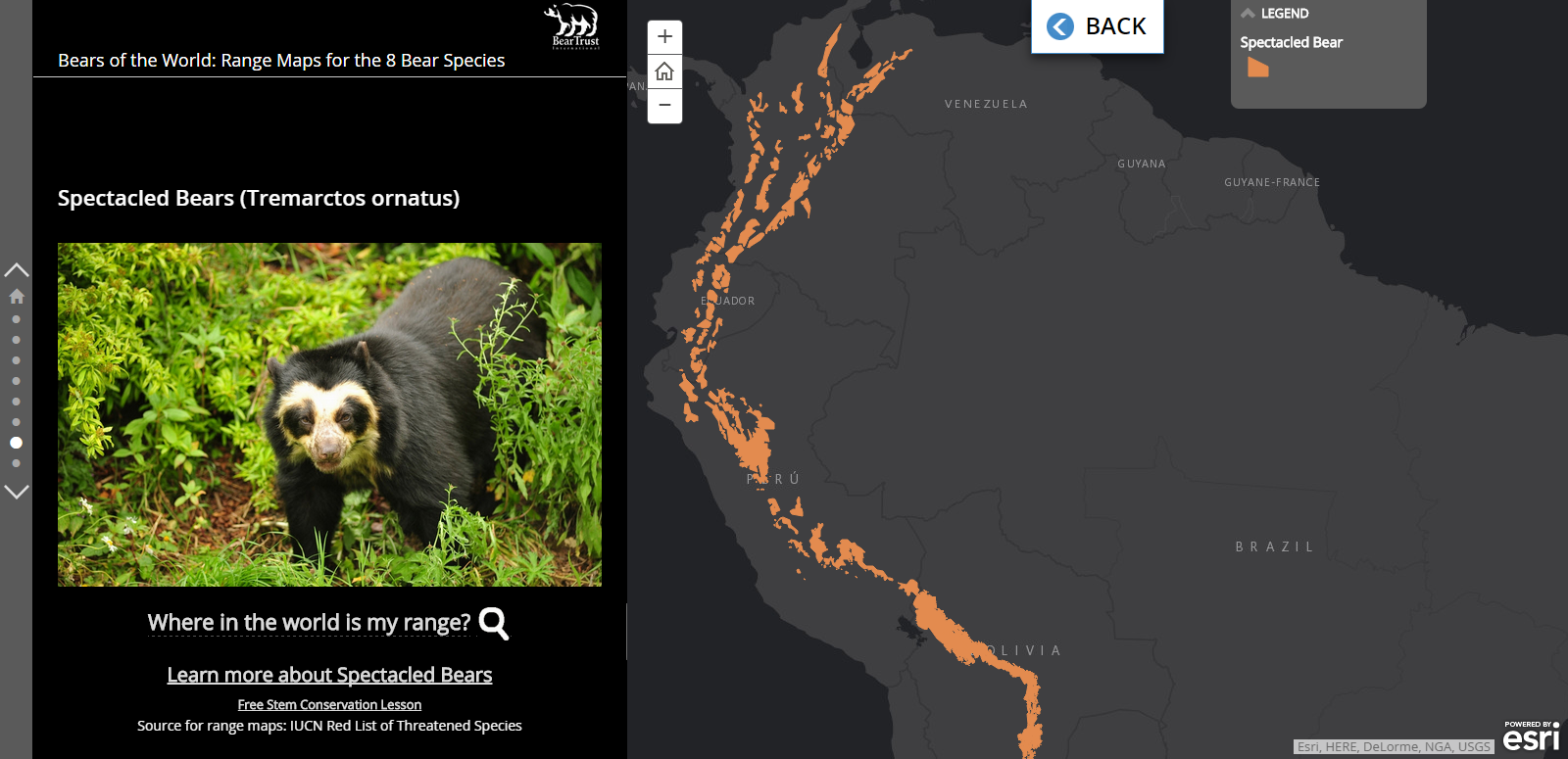
The Bear Trust International Bears of the World story map, created by our friends at Blue Raster. The Bear Trust wanted to create lessons centered around bear research and ecology.


The MapED open data homepage - a central location for accessing the vast data collections of the US Department of Education, National Center for Education Statistics.


This Climate Connections map, and the rest of the ISTE Mapping collection housed by PBS.


When it comes to GIS, there really is something for everyone, wherever your interests lie.


Jené Grandmont
Senior Manager, Application Development and Data Services
HealthLandscape

Wednesday, November 4, 2015

Everything That’s Old is New Again

You’ve been hearing a lot about population health, social determinants of health and community vital signs lately from the team here at HealthLandscape.  That’s because we are hearing about it a lot lately from you.

We are currently working on a number of projects that help health care researchers and providers access these data.  We are working on projects that make these community-level data available at the patient level so that practices can understand the community from which they are drawing patients; so that providers have community context for the patient sitting in front of them; so that researchers can better understand community-level effects on patient outcomes.  To these ends, we have developed the Community Vital Signs API which will geocode and geoenrich patient-level, clinical information systems’ data.  For more information, please visit: http://communityvitalsigns.healthlandscape.org/

I was honored to be invited to speak at the Osteopathic Medical Conference and Exposition as part of a two-hour session discussing the old concept of Community Oriented Primary Care (COPC) in their Medical Informatics section.  This old concept of treating the whole community, not just the patients that show up in the doctor’s office, is the foundation of all the current interest in patient- and community-centeredness in medicine.   It’s exciting to be part of the movement that may finally help COPC find its footing in mainstream health care circles.  In our session, we discussed how one medical school is training providers to learn how to incorporate these community-level data into treatment decisions and see them as just as important as weight, blood pressure and heart rate.  We showed providers who were not trained in these methods how they can access the community-level data and begin to integrate them into their practices.

This is a part of ongoing work that started with the Robert Graham Center and the National Association of Community Health Centers a few years ago.  If you would like to learn more about that or access a full curriculum to help you learn the tenets of COPC, please visit: http://www.graham-center.org/rgc/maps-data-tools/tools/copc.html. 

 If you would like to learn more about the work that HealthLandscape is doing related to Community Vital Signs, Social Determinants of Health, or Community Oriented Primary Care, contact Jennifer Rankin, jrankin@healthlandscape.org or Mark Carrozza, mcarrozza@healthlandscape.org.  We’d love to discuss it with you.

Jennifer Rankin
Senior Manager, Research and Product Services
HealthLandscape

Wednesday, October 28, 2015

What Counts? Data Forum Focuses on Innovations in Population Health

How do we move from data to action? I’m excited to be joined by a series of speakers this Thursday (October 29th) at Data! Fostering Health Innovation in Kentucky and Ohio in Erlanger, KY, where we will be exploring this question and presenting recent innovations in improving population health.

As part of a panel focusing on the validity and use of data to address social determinants, I’ll be presenting HealthLandscape’s most recent work on Community Vital Signs, an approach for incorporating community indicators into electronic health records.  Also joining me on the panel are Katie Bachmeyer from Starfire, and Dr. Robert Kahn from Cincinnati’s Children’s Hospital.
Keynote speakers for the conference include Niall Brennan, the Chief Data Officer of the Centers for Medicare and Medicaid Services, and Naomi Cytron, Senior Research Associate in the Community Development Department for the Federal Reserve Bank of San Francisco.
 
Michael Topmiller
Health GIS Research Specialist 
HealthLandscape