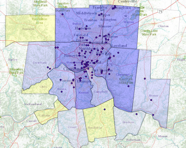
Explore the distribution of primary care physicians by state, county, or census tracts (in metropolitan areas) with the new Primary Care Physician Mapper.
The Primary Care Physician Mapper uses National Provider Identifier (NPI) data, and displays information for any provider who bills Medicare, Medicaid, or certain private insurance companies.
Users can visualize raw counts of physicians or create maps showing the ratio of one or more primary care specialties to the population within a selected geography.
The app, developed by HealthLandscape, is a project of the Robert Graham Center. There is no cost to users. For more information contact us at info@healthlandscape.org or visit www.HealthLandscape.org.
County-level map displaying the population to pediatric physicians in the Greater Cincinnati, Ohio, region.
Census tract-level map displaying the population to pediatric physicians with a threshold of at least 350 persons per provider in the Greater Cincinnati, Ohio, region.
Map displaying number and location of pediatricians in the Greater Cincinnati, Ohio, region.


No comments:
Post a Comment